Fresno State Transportation Institute
Infographics
Transportation Infrastructure and Planning:
-
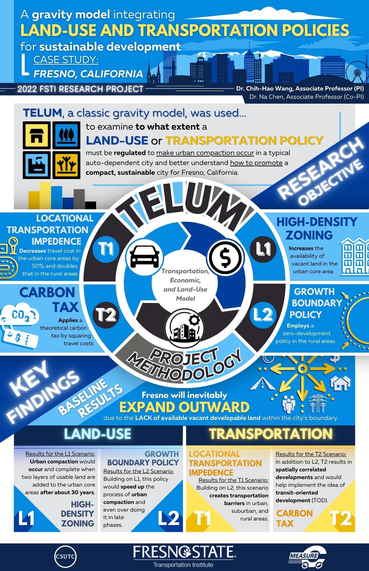
A Gravity Model Integrating Transportation Investments and Land-Use Planning for Sustainable Development -
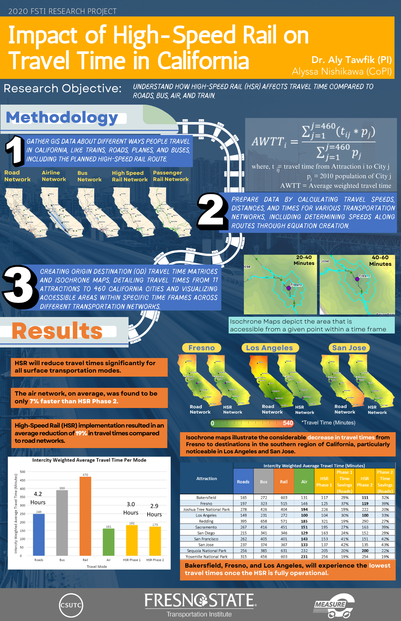
Using Isochrone Maps and OD Matrices to Assess the Impact of the High Speed Rail on Multimodal Regional Mobility in California -
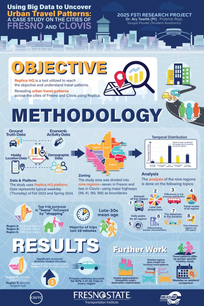
Using Big Data to Uncover Urban Travel Patterns: A Case Study on the Cities of Fresno and Clovis -
Public Health and Safety:
-
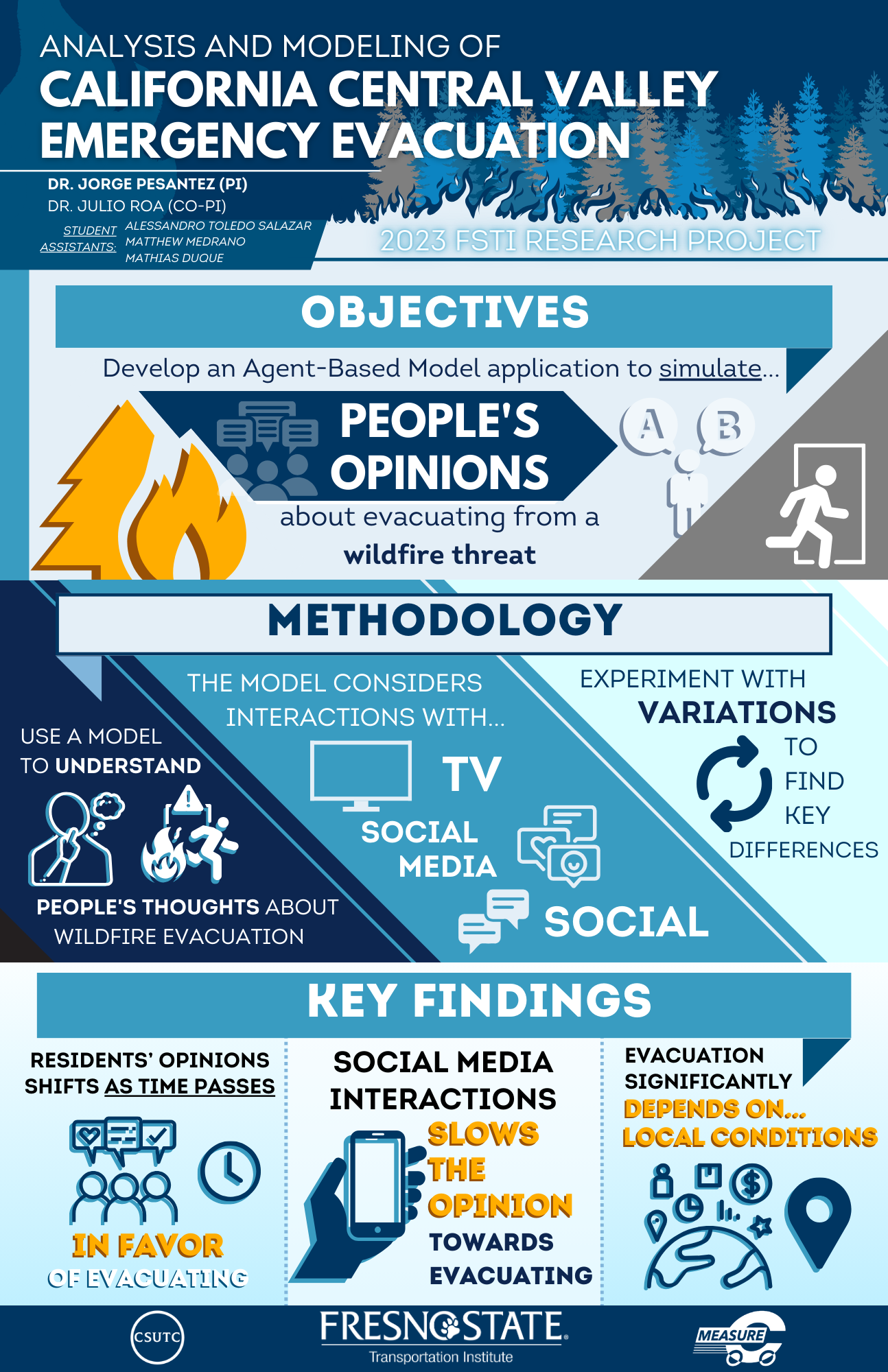
Emergency Evacuation Modeling for Wildfires -
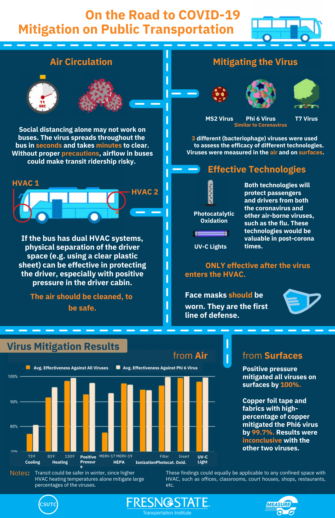
Public Transportation Air Circulation and Virus Mitigation Study -
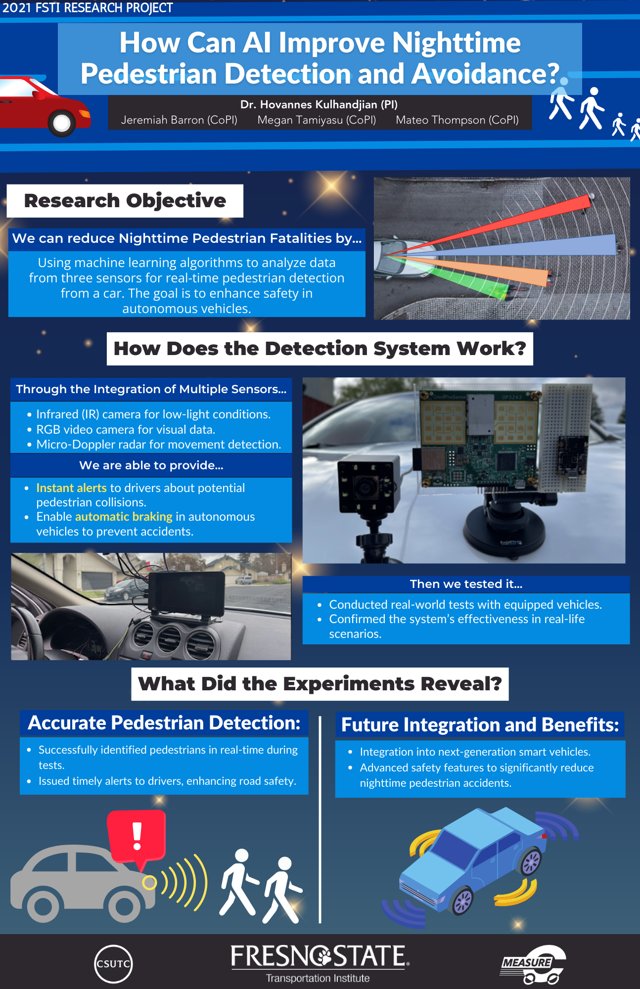
AI-based Pedestrian Detection and Avoidance at Night using IR Camera, Radar and Video Camera -
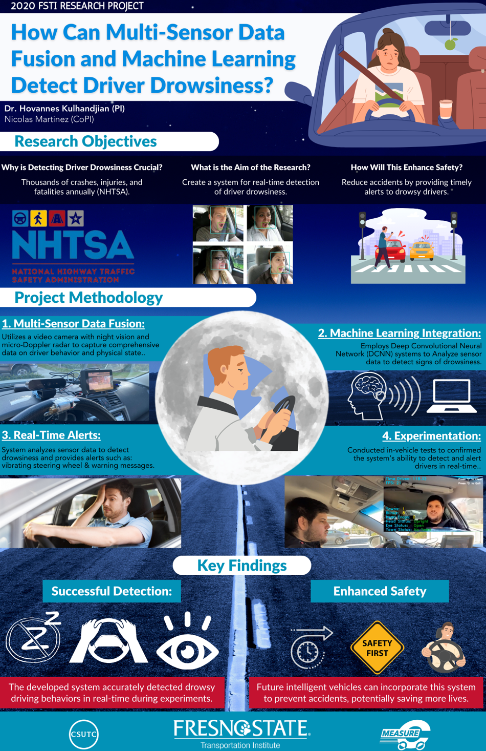
Detecting Driver Drowsiness with Multi-Sensor Data Fusion combined with Machine Learning
-
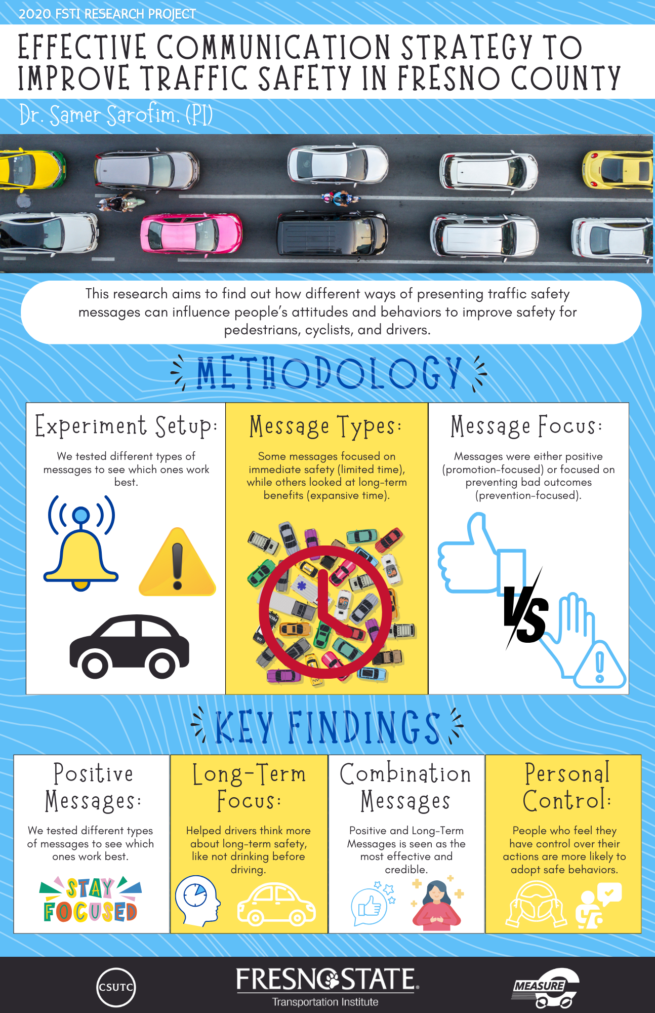
Effective Communication Message Strategy for Enhancing Traffic Safety in Fresno County: The Role of Time Horizon, Locus of Control, and Regulatory Focus -
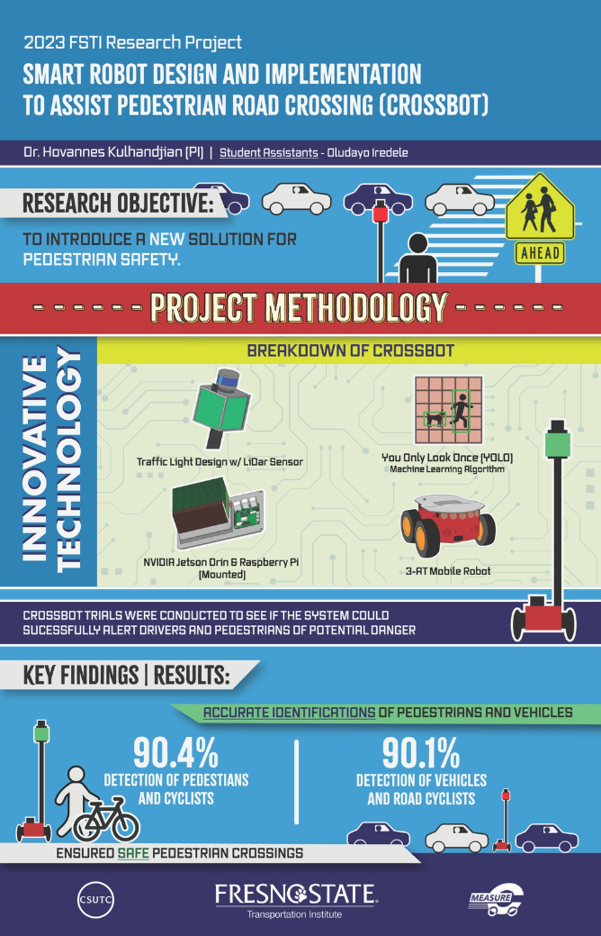
Smart Robot Design and Implementation to Assist Pedestrian Road Crossing -
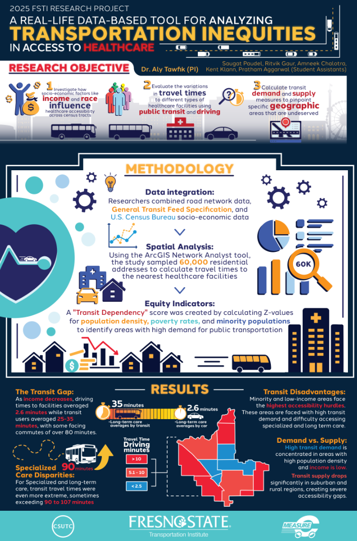
A Real-Life Data-Based Tool for Analyzing Transportation Inequities in Access to Healthcare -
Alternative Transportation and Sustainability:
-
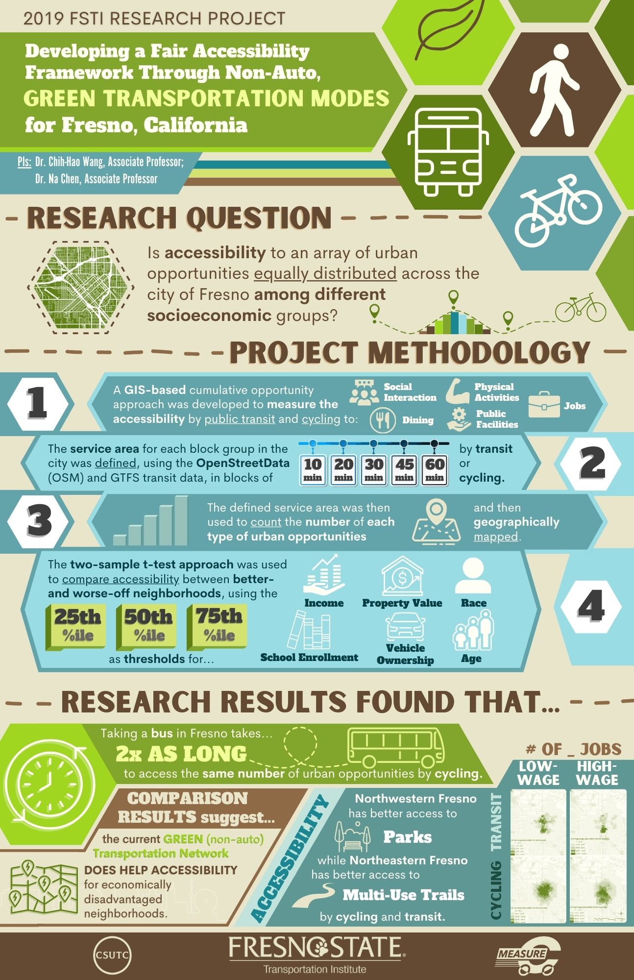
Developing a fair accessibility framework through non-auto transportation modes for Fresno, CA
-
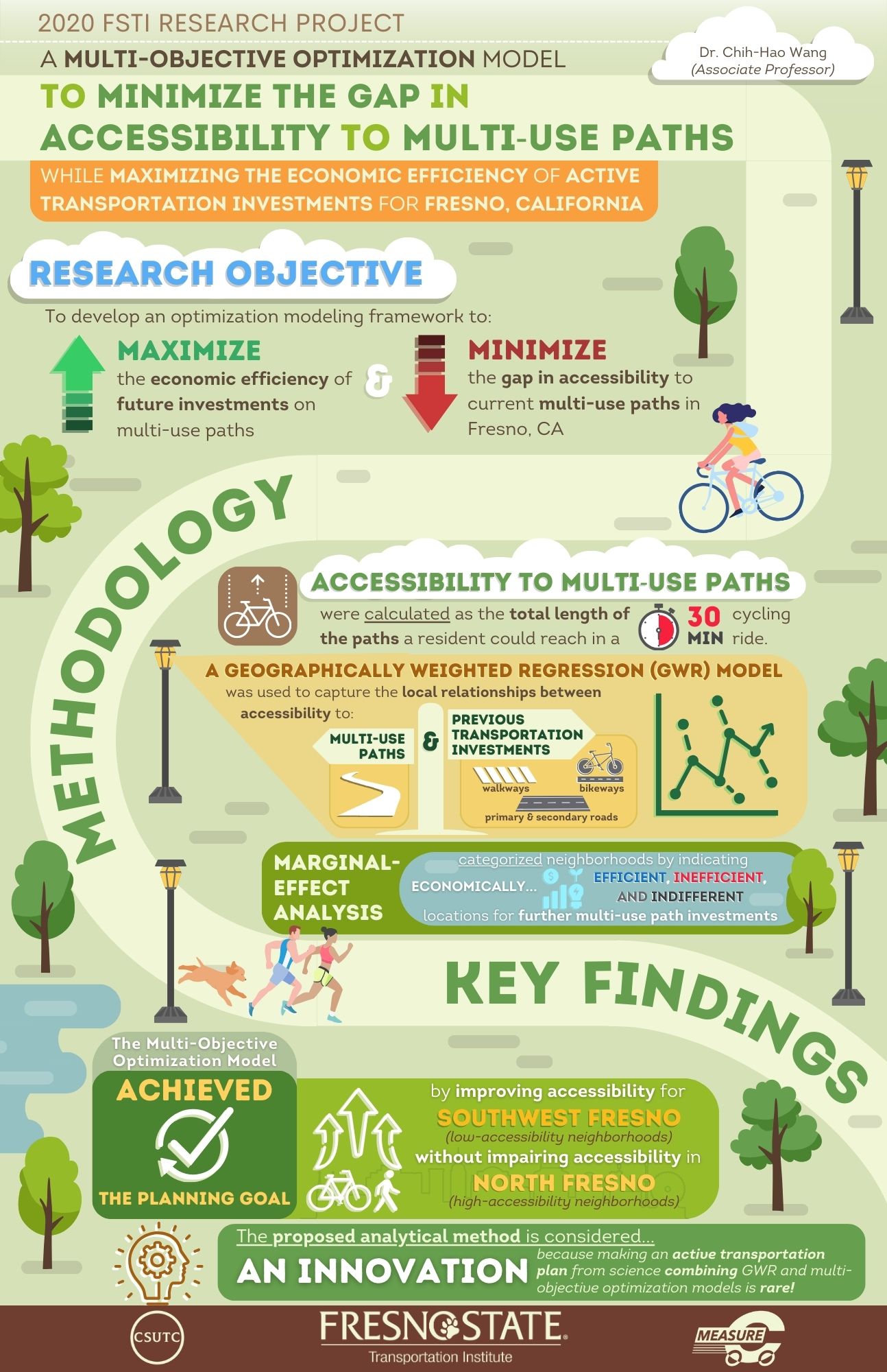
A Multi-objective Optimization Model to Minimize the Gap in Accessibility to Multiuse Paths While Maximizing the Economic Efficiency of Active Transportation Investments for Fresno, California -
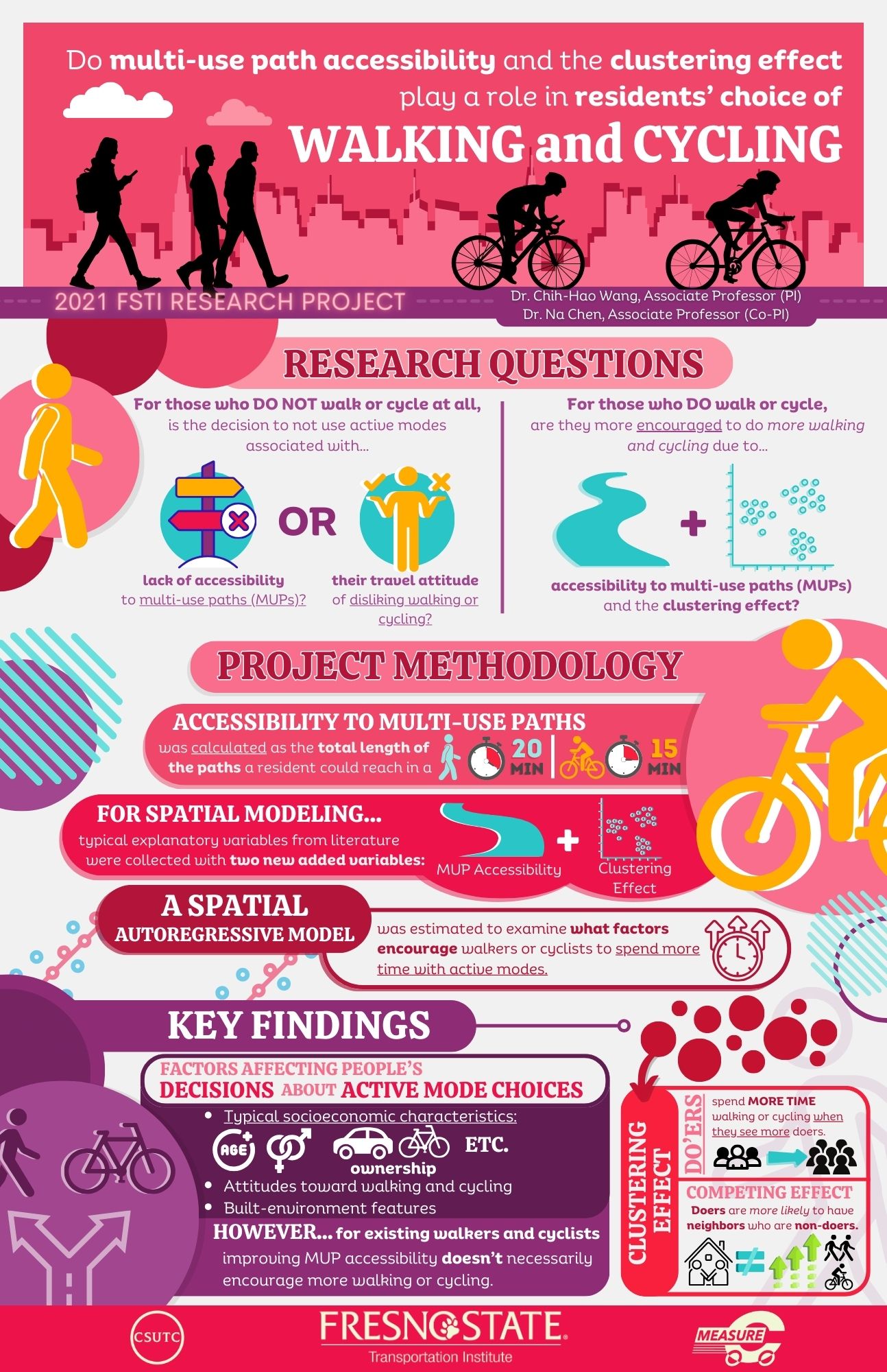
Do Multi-use Path Accessibility and the Clustering Effect play a Role in residents' Choice of Walking and Cycling -
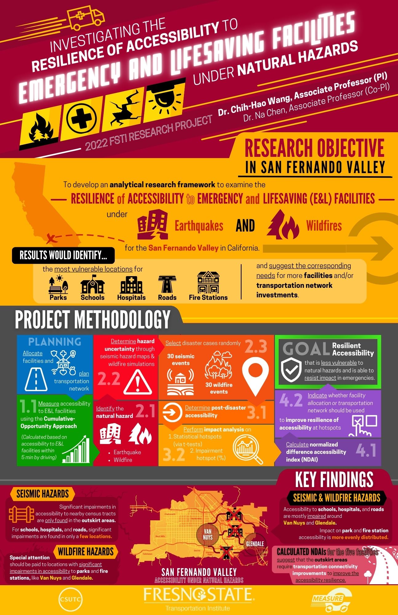
A GIS-Based Network Analysis to Investigate the Vulnerability of Accessibility to Emergency and Lifesaving Facilities under Threats of Natural Hazards
-
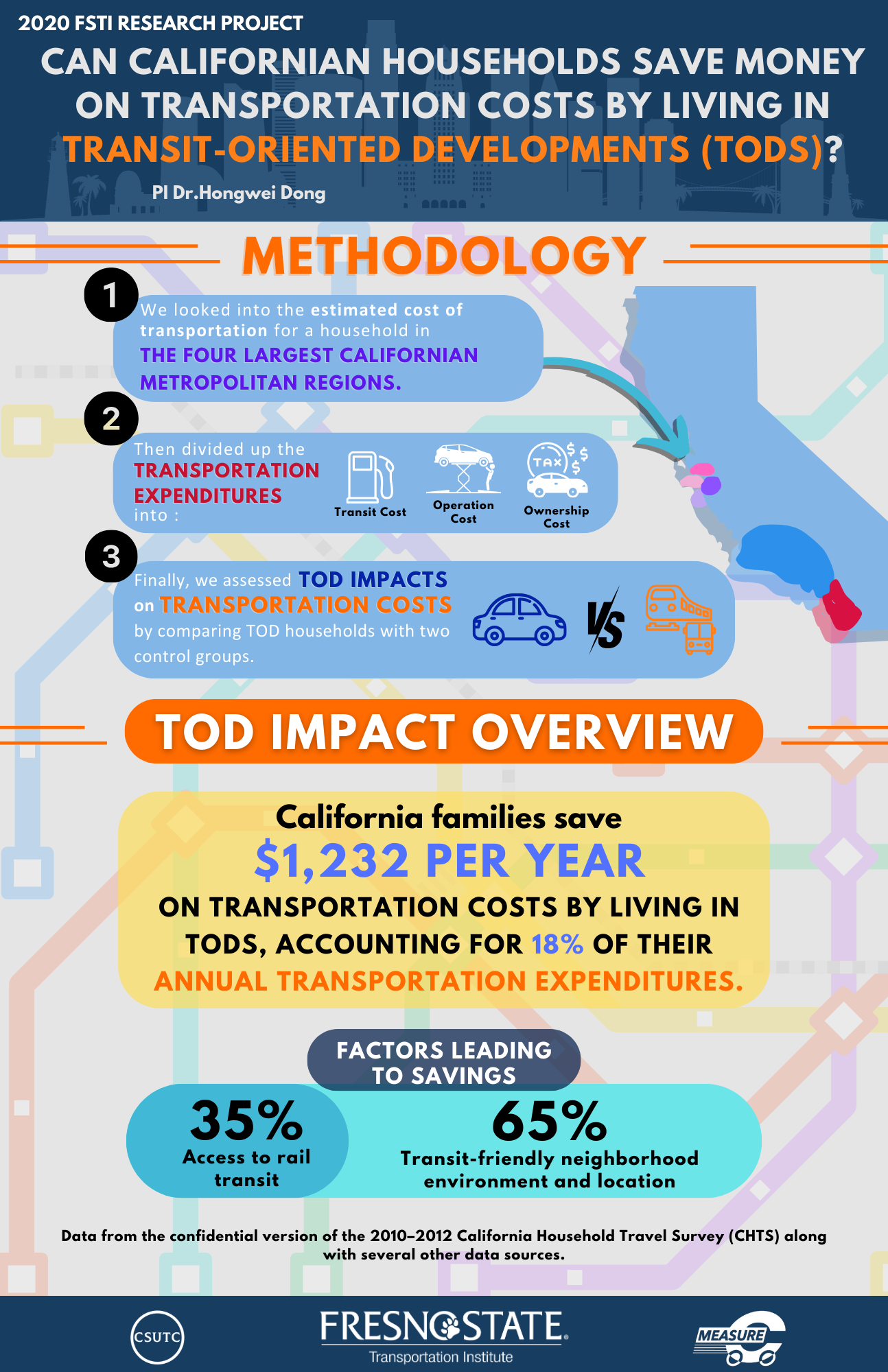
Do Californian Residents Save Money on Transportation Costs by Living in Transit-Oriented Developments? -
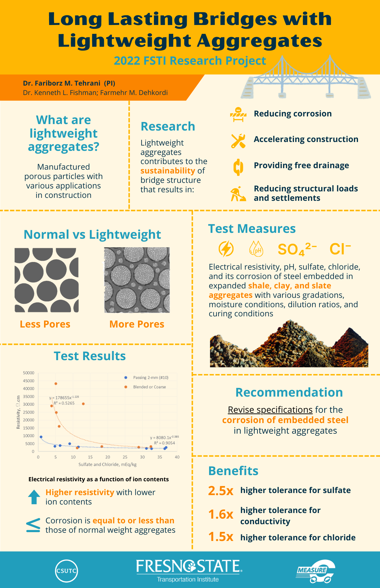
Extending the Service-Life of Bridges using Sustainable and Resilient Abutment Systems: An Experimental Approach to Electrochemical Characterization of Lightweight Mechanically Stabilized Earth -
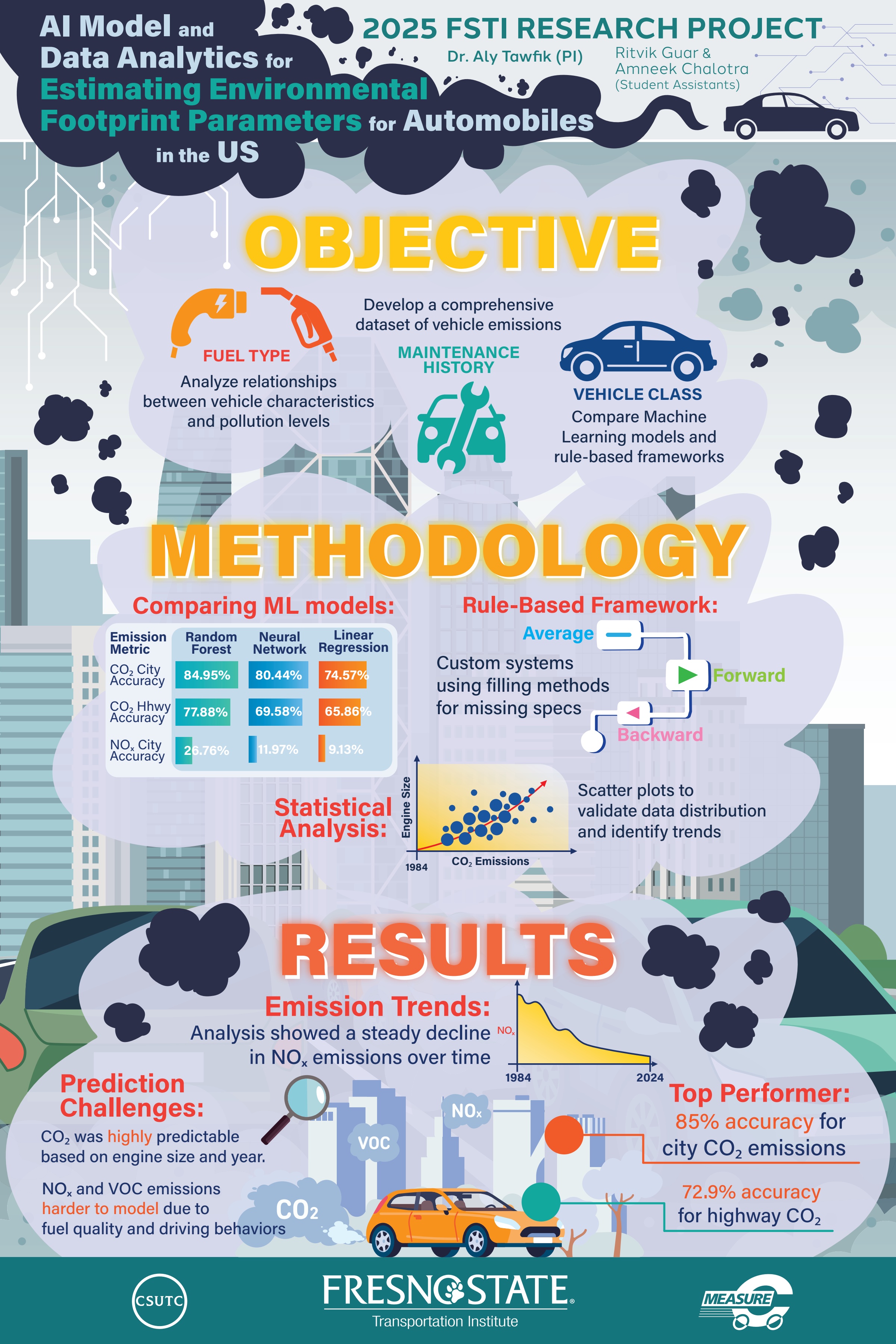
AI Model and Data Analytics for Estimating Environmental Footprint Parameters for Automobiles in the US -
Technology and Innovation in Transportation:
-
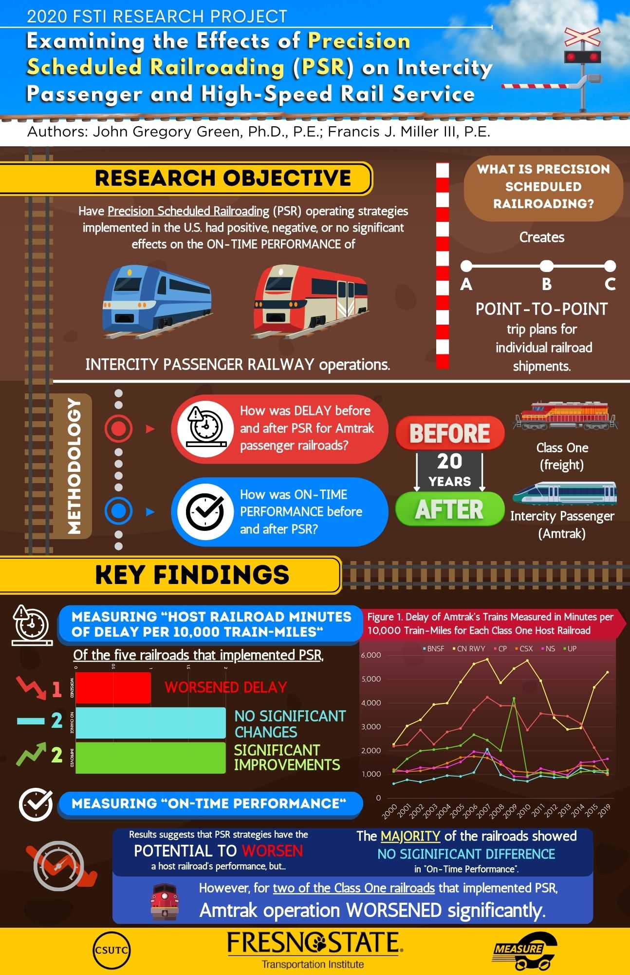
Examining the Effects of Precision Scheduled Railroading on Intercity Passenger and High Speed Rail Service -
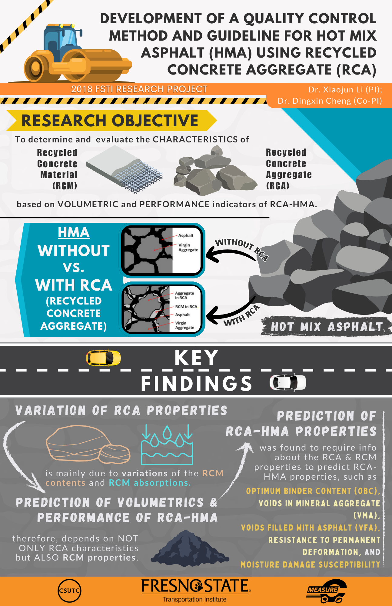
Development of a Quality Control Method and Guideline for Hot Mix Asphalt (HMA) Using Recycled Concrete Aggregate (RCA) -
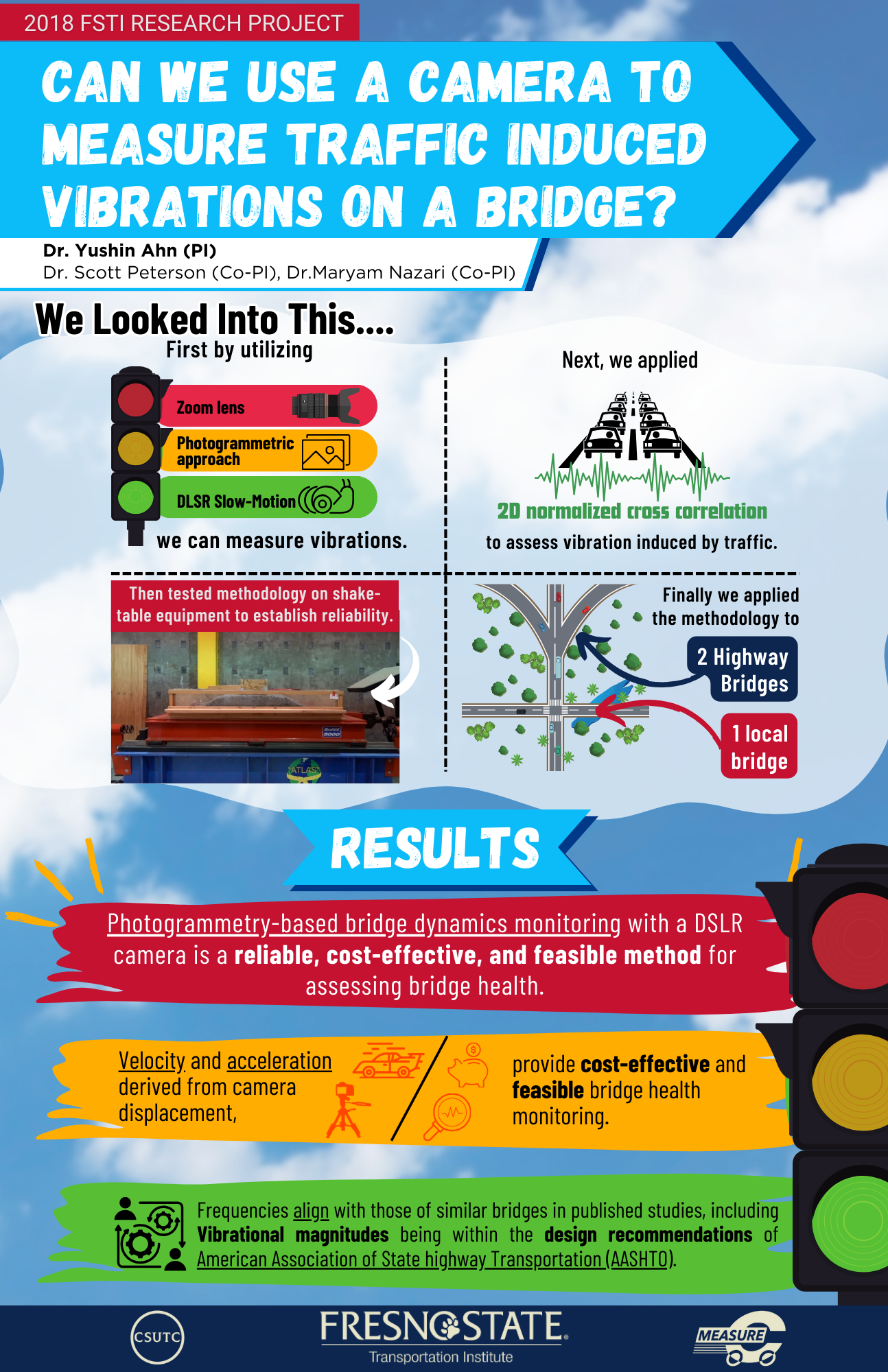
Bridge Monitoring Using a Digital Camera: Photogrammetry-based Bridge Dynamics Monitoring -

Traffic sign extraction from Mobile LiDAR point cloud
-
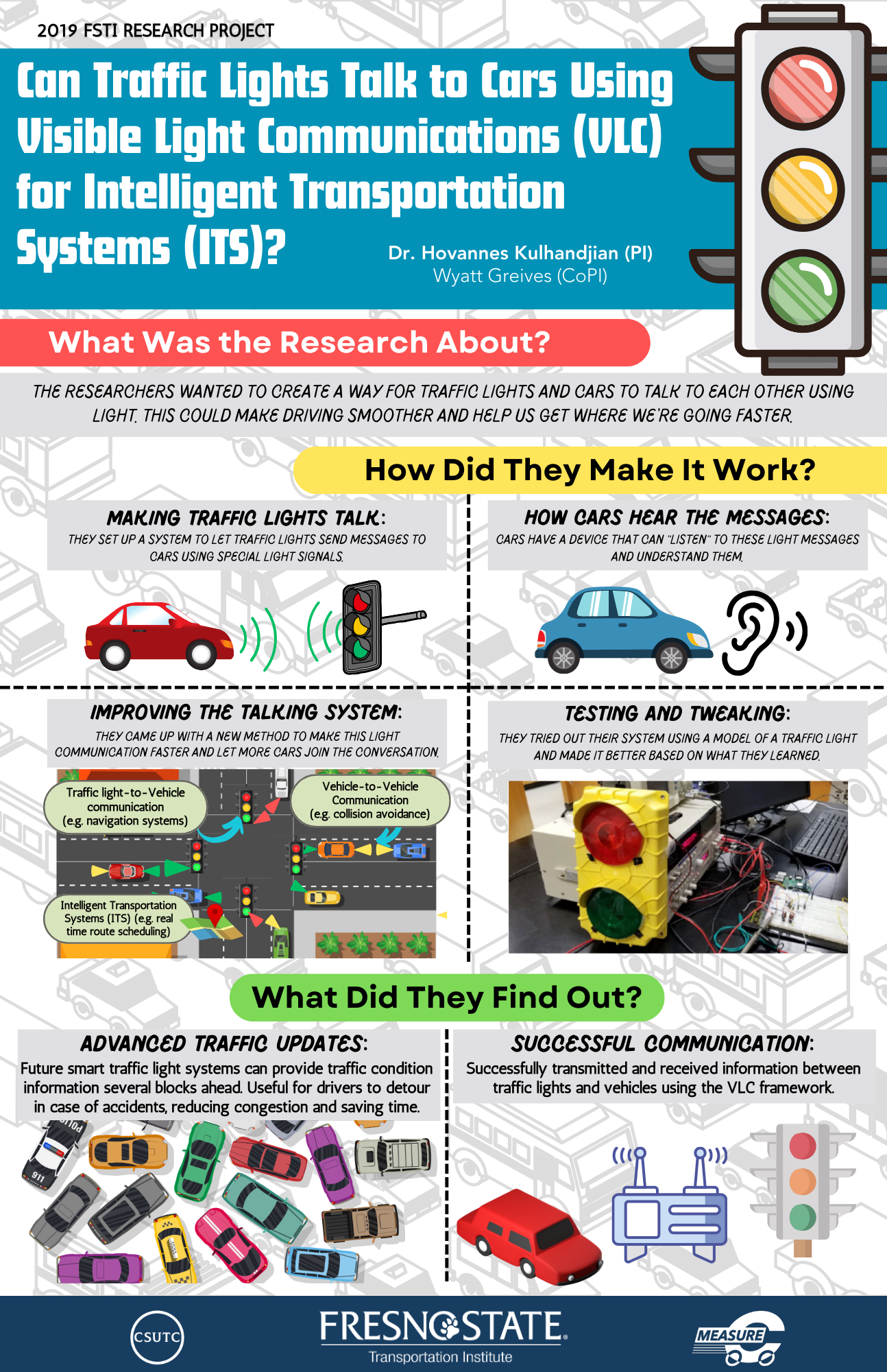
Visible Light Communications Framework for Intelligent Transportation Systems -
-
-
Community Engagement and Education:
-
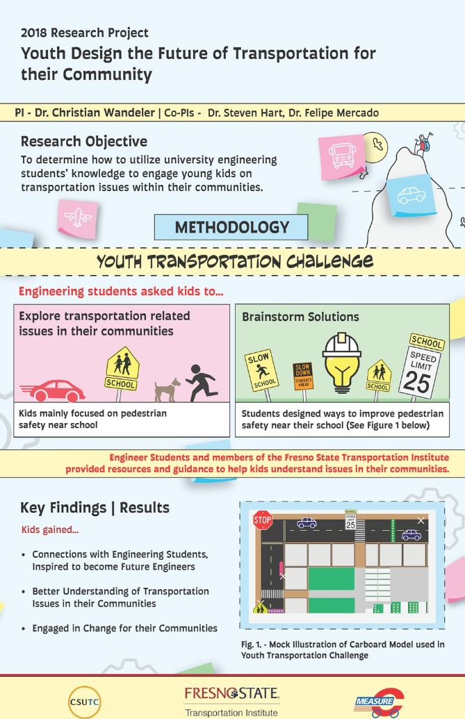
Youth Design the Future of Transportation for Their Community -
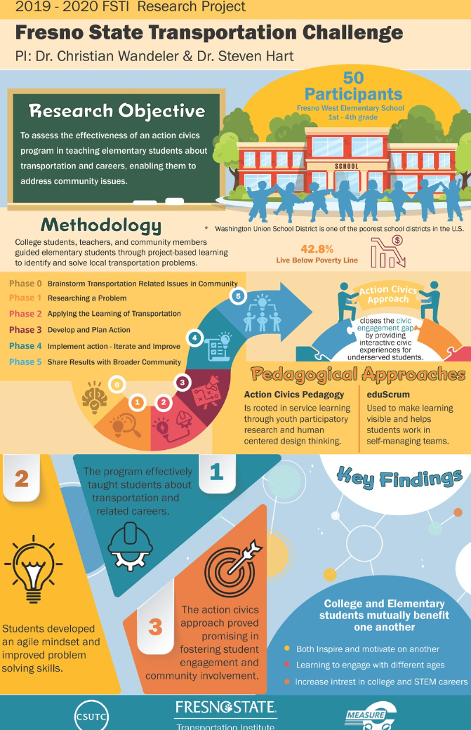
Fresno State Transportation Challenge -
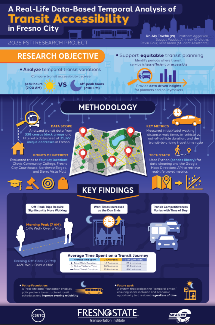
A Real-Life Data-Based Temporal Analysis of Transit Accessibility in Fresno City -
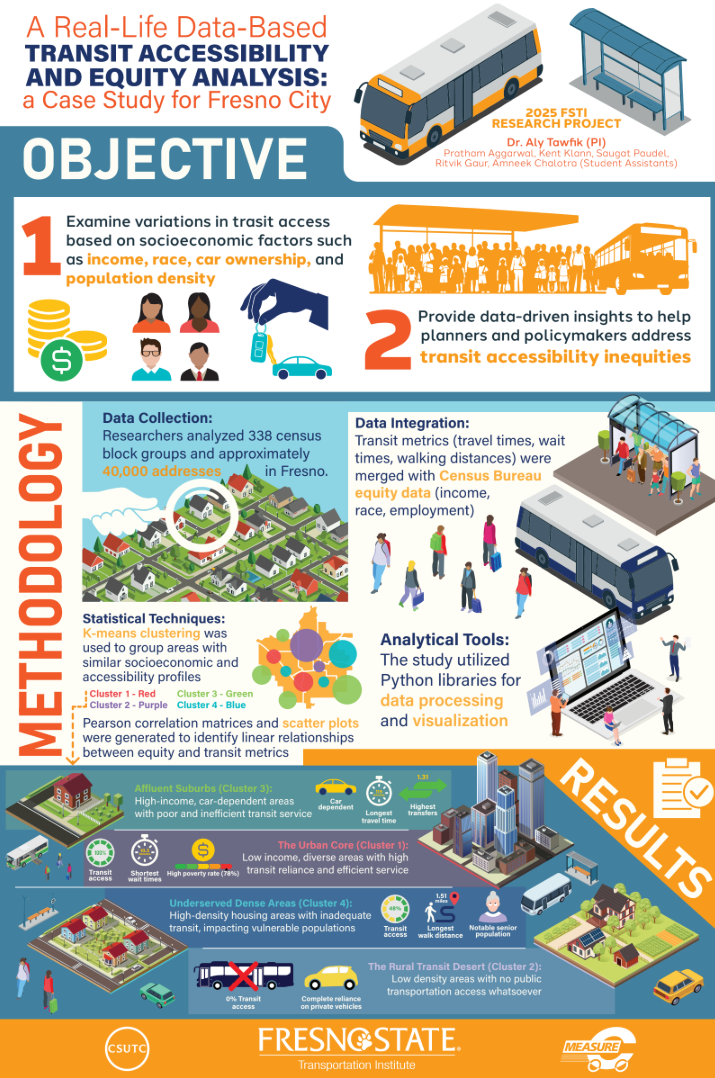
A Real-Life Data-Based Transit Accessibility and Equity Analysis: A Case Study for Fresno City -
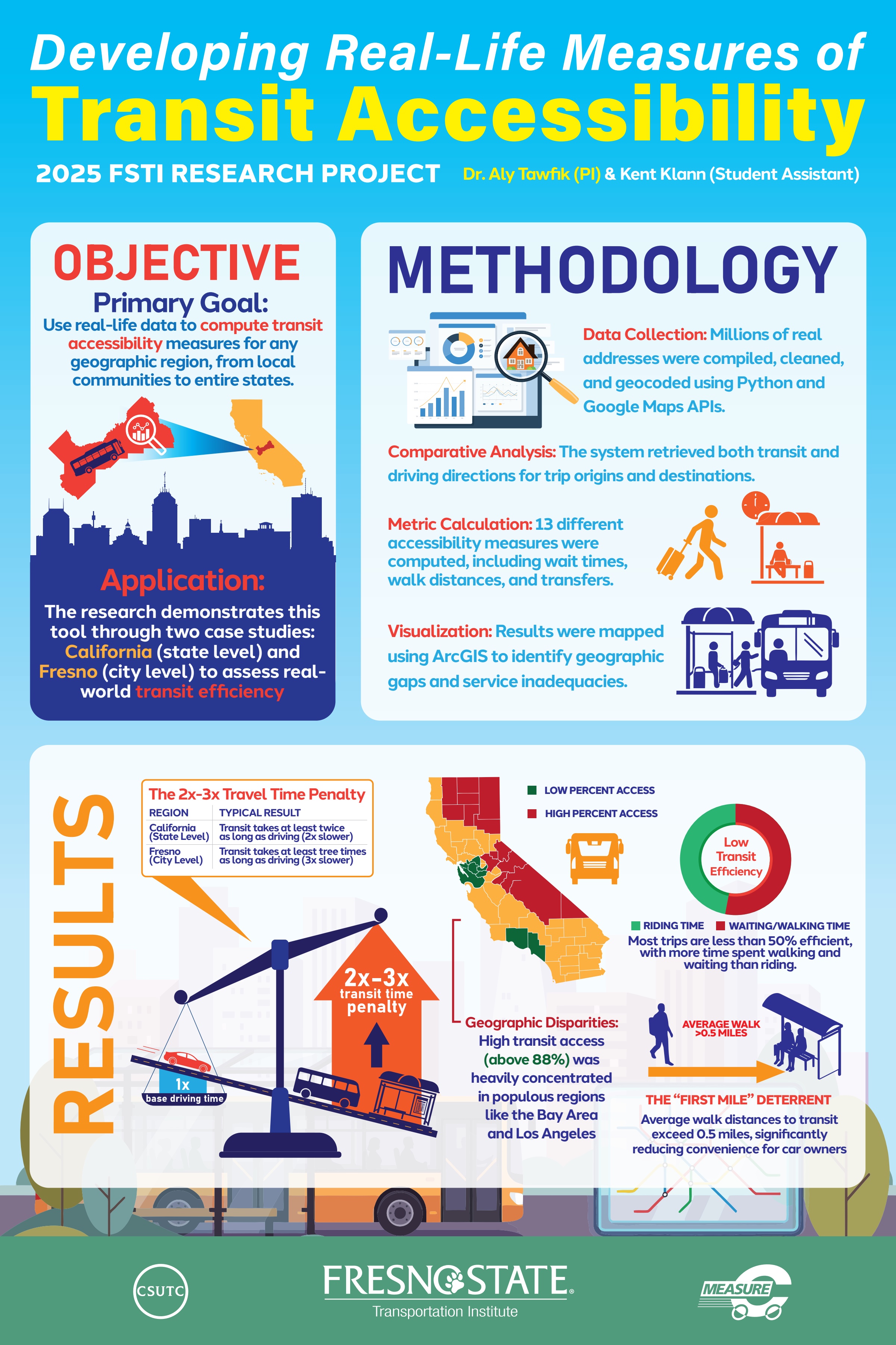
Developing Real-Life Measures of Transit Accessibility -
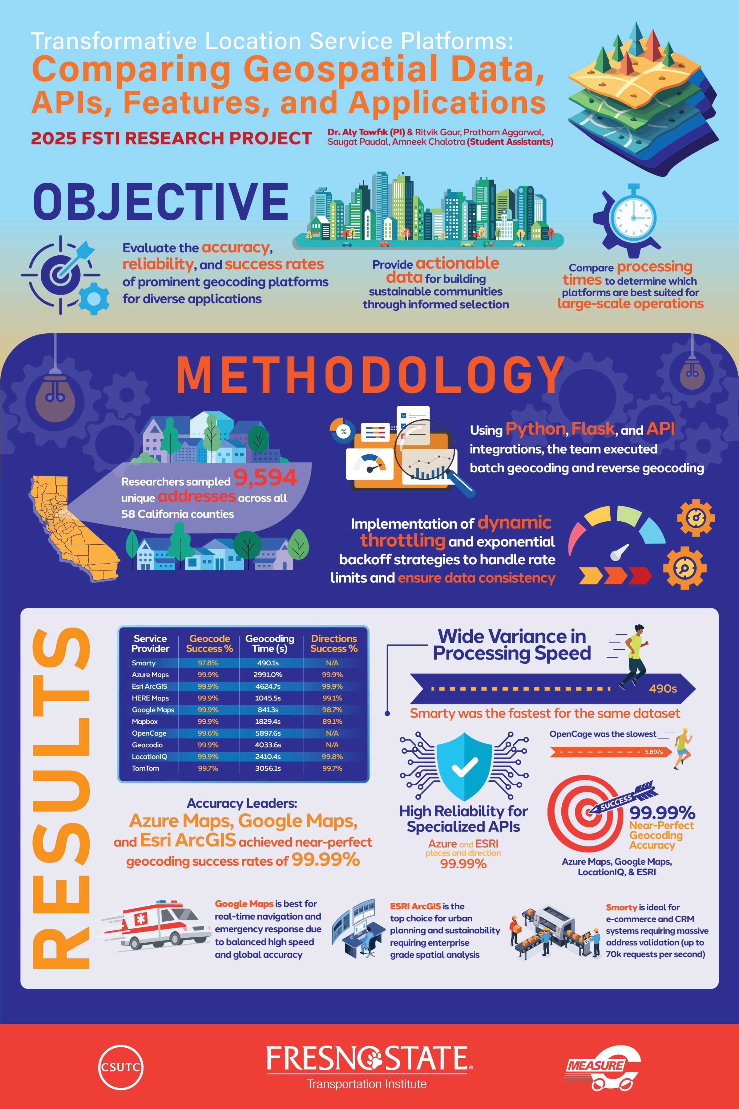
Transformative Location Service Platforms: Comparing Geospatial Data, APIs, Features, and Applications -
-
Interested